Average Face of a Country: What the 48 Pages Rest On
A country page carries a composite face on the surface and, underneath it, a layer of catalogue entries that is far patchier than the images suggest. The median page has its nearest entry 278 kilometres away.
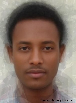
A page holds two different things
Every country page on this site carries two layers that are easy to mistake for one. The visible layer is a composite face, built by aligning many portraits on shared landmarks and averaging them. The hidden layer is a set of catalogue entries, each with a name, a recorded region, a list of traits and a bibliography. The composite answers what the average of a photograph pool looks like. The entries answer which documented patterns were described in that part of the world, and by whom.
The check on the second layer is straightforward. Take each page's reference coordinate, take the recorded location of all 209 catalogue entries, measure the great-circle distance between them, and keep the closest. That single number says how far you travel from a country's nominal centre before the catalogue has anything to say about the ground under your feet. The results are more uneven than the polished images suggest, and the unevenness has a cause worth naming.
How far the nearest entry sits
Across the forty-eight pages the median distance to the closest entry is 278 kilometres. Twenty-one pages have no entry within 300 kilometres of their coordinate, and seven have nothing within 500. Germany is the extreme in one direction: Central Brachid is recorded at almost exactly the country's reference point, so the distance rounds to zero. Russia is the extreme in the other, at 838 kilometres, its nearest neighbour being Yenisey, a Siberian subtype of the Yenisei basin recorded among the Ket. The United States sits 551 kilometres from Planid, Bangladesh 520 from Kolid, and Nigeria 701 from West Bambutid.
Distance to a nearest neighbour is not a figure invented for this page. Clark and Evans published the measure in Ecology in 1954 to describe how a set of points is spaced, comparing the observed mean distance with the value expected under random placement, which at density rho is one over twice the square root of rho. Their ratio runs from zero, where every point sits on top of every other, to about 2.15, where points are spread as evenly as a hexagonal lattice permits. They were explicit about the weakness that matters here: the answer depends on where the boundary is drawn.
Where the catalogue is dense
Counting entries within 500 kilometres rather than measuring the first one changes the picture and begins to explain it. Hungary and the Czech Republic reach six each, Austria and Finland five, Sweden four, Romania and Switzerland three. Twenty-two of the forty-eight pages are European, and the catalogue's regional tally is heavier still in the north of that continent, with fourteen entries logged for Northern Europe against seventeen for all of Sub-Saharan Africa, an area many times larger.
Almost every entry closes with a short bibliography, and those bibliographies cluster around a small number of institutes. Eickstedt's Rassenkunde, Lundman's Geographische Anthropologie and Biasutti's four-volume handbook recur across dozens of entries, and authors working in the German, Swedish and Italian traditions named patterns in the regions their institutions could reach. Where a survey was run, a type was described. Where no survey was run, the catalogue is silent. The density is a map of fieldwork, and fieldwork followed funding, empire and the careers of individual anatomists.
A country centre is not its people
The reference coordinate on each page is a geometric centre, and a geometric centre can fall almost anywhere. Egypt is the clearest case. Roughly 95 percent of the population lives on about 5 percent of the land, in the Nile valley and the Delta, while the coordinate sits near 26.8 north and 30.8 east, out in the desert west of the river. The nearest entry, Egyptid, is 221 kilometres away, and the page has a single entry inside 300 kilometres. That number describes the coordinate rather than the country.
Russia repeats the problem at continental scale. Its coordinate falls near 61.5 north and 105.3 east, deep in Siberia and hundreds of kilometres from the European core where most of the population lives. The nearest entry is Yenisey, recorded for the basin of a river draining a territory larger than most countries and associated with the Ket, a people the entry itself puts at around a thousand individuals. Ethiopia makes the same point vertically: the coordinate sits in the lowlands while Central Ethiopid is described for the highlands and among Oromo speakers, more than 500 kilometres away.
The zoning problem has a name
Geography has a term for what happens when a continuous surface is summarised inside an arbitrary boundary: the modifiable areal unit problem. Openshaw and Taylor set it out in 1979, in a paper whose title gives the scale of the difficulty, A million or so correlation coefficients. Working with the 99 counties of Iowa, they correlated the share of residents over sixty with the share voting Republican in 1968, then recomputed that correlation for every possible grouping of the same counties. Aggregated into six zones, the coefficient ranged from minus 0.999 to plus 0.999.
The paper separates a scale effect from a zonation effect, and both press on a country page. Change how many units you aggregate and the summary moves. Hold the count fixed and redraw the boundaries and it moves again. A country is one zoning of a cline that does not stop at the border, so its composite is one member of an enormous family of averages computable from the same photographs, with no claim to be the average. Two country pages are two zonings, which is why they cannot be placed in an order.
What changed after the baseline
The two layers also carry different dates. The composite is built from photographs that exist now and are usually recent uploads, which makes it a picture of the twenty-first century. The entries were written from surveys made mostly between the 1880s and the 1970s, and they are explicitly anchored to a baseline of roughly 1,500 years ago. A page therefore places a contemporary average beside a description of a much older distribution, and the gap between the two is where most of the instructive error lives.
Some entries admit the movement in their own wording. Assyroid, named by Deniker in 1900, is recorded as historically important in the Hittite and Assyrian worlds, diluted since, carried by medieval migrations into India, Africa and Europe, and more recently spread to the Americas. The Iraq page sits 65 kilometres from that entry yet has only one entry within 300 kilometres. A single coordinate cannot express any of that movement, which is the point: the catalogue describes a distribution that has been in motion since it was written down.
Three checks before trusting a page
None of this makes the pages unusable. It makes them specific, and the specificity is readable if you look in the right order. The image is the part everyone examines first and the part that carries the least information per pixel. Three checks take about a minute and settle most of what a reader actually wants to know about a national average, without needing statistics beyond a ruler held against a map.
Read in that sequence, an index of forty-eight averages becomes useful in a modest way. It tells you where a documented pattern was placed, how much literature stands behind the placement, and how far the picture sits from the record. It also tells you where the index is silent, which is often the more useful half of the answer. That is a locator, not a verdict, and it is what the page was built to be.
- Check the distance before the picture. A page whose coordinate sits several hundred kilometres from its nearest entry has a thin second layer, whatever the composite looks like.
- Check the bibliography. One or two references mean a single survey, and a single survey often means one village, school or regiment stood in for a country.
- Check the wording. A composite is a mean and not a portrait, and a page calling it the face of a nation has stopped describing and started asserting.
- Check what the country name is doing. It locates a page in an index; it does not certify anyone's nationality, and no average can.
Frequently Asked Questions
- Is the average face of a country the same as the average of its people?
- No. The coordinate on a country page is a geometric centre, and populations are rarely arranged around it. Egypt is the standard illustration, with about 95 percent of its people on roughly 5 percent of its land. The composite is also drawn from a photograph pool that skews urban, young and self-selected. The image summarises a sample standing near a coordinate, and both the sample and the coordinate are choices rather than facts about a nation.
- Why do some country pages link to only a few catalogue entries?
- Because the catalogue records where surveys were carried out, not where people live. Of the forty-eight pages, twenty-one have no entry within 300 kilometres of their coordinate and seven have nothing within 500. Europe is dense because the typological literature was produced largely in European institutes, and large parts of Asia, Africa and the Americas were covered by fewer expeditions. A thin page reflects the history of fieldwork.
- Can two country averages be compared or ranked?
- Not on a single scale, and the reason is statistical rather than diplomatic. Each page summarises a different sample inside a different polygon, and Openshaw and Taylor showed in 1979 that redrawing zones can move a correlation from minus 0.999 to plus 0.999 on identical data. Averaging removes variation rather than measuring it, so a composite supplies no unit in which one country could be called more typical than another. Compare a page with its own entries instead.
Related Phenotypes
Faces from the encyclopedia that appear in this article. Open any entry for its full description, distribution, and references.
Central Ethiopid
East Africa
Ethiopid subtype of the central Ethiopian highlands and their surroundings. Found in its purest form among Oromos. Also in other Cushitic sp...
Planid
North America
Native American type, named after the Great Plains of North America. In pre-Colombian times concentrated in the Central Canadian forests fro...
Assyroid
Middle East
Semitic type that unites Armenoid with Arabid features. Historically important in the ancient Hittite Kingdom and the Assyrian civilisation....
Central Brachid
Central Europe
Indo Brachid variety, with a morphological and geographical position between West and East (Indo) Brachids, but possibly resulting from diff...
Test what you learned
Put your eye for regional faces to work in the daily quiz — a composite face, a world map, and your best guess.